If this is your first visit, be sure to
check out the FAQ by clicking the
link above. You may have to register
before you can post: click the register link above to proceed. To start viewing messages,
select the forum that you want to visit from the selection below.
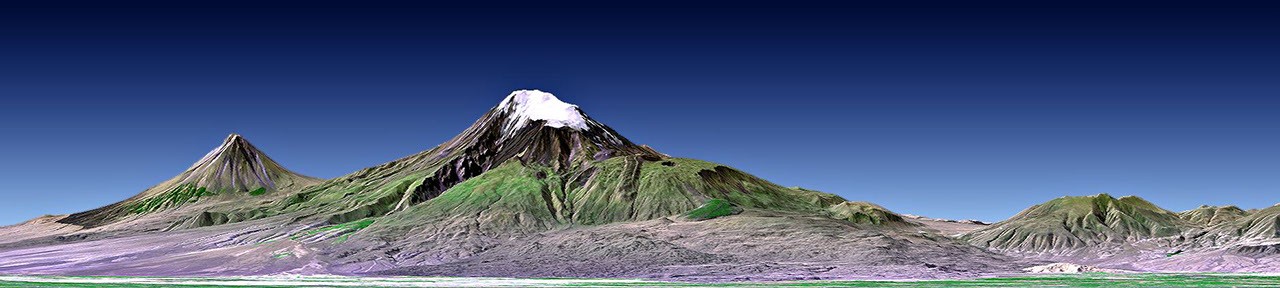
This perspective view shows Mount Ararat in easternmost Turkey, which has been the site of several searches for the remains of Noah's Ark as seen by NASA's Shuttle Radar Topography Mission.
"This image was generated from a Landsat satellite image draped over an elevation model produced by the Shuttle Radar Topography Mission (SRTM). The view uses a 1.25-times vertical exaggeration to enhance topographic expression. Natural colors of the scene are enhanced by image processing, inclusion of some infrared reflectance (as green) to highlight the vegetation pattern, and inclusion of shading of the elevation model to further highlight the topographic features."
I agree, the image does not look very artistic with the bad choice of colors. But I thought it was pretty cool that NASA made a tomography of Mount Ararat.
The flag was the first thing I thought of when I saw the blue sky. And I needed to find a way to make it fit my desktop better. So BAM! 5 minute photoshop job.

 Tweet
Tweet


Comment