


 Tweet
Tweet
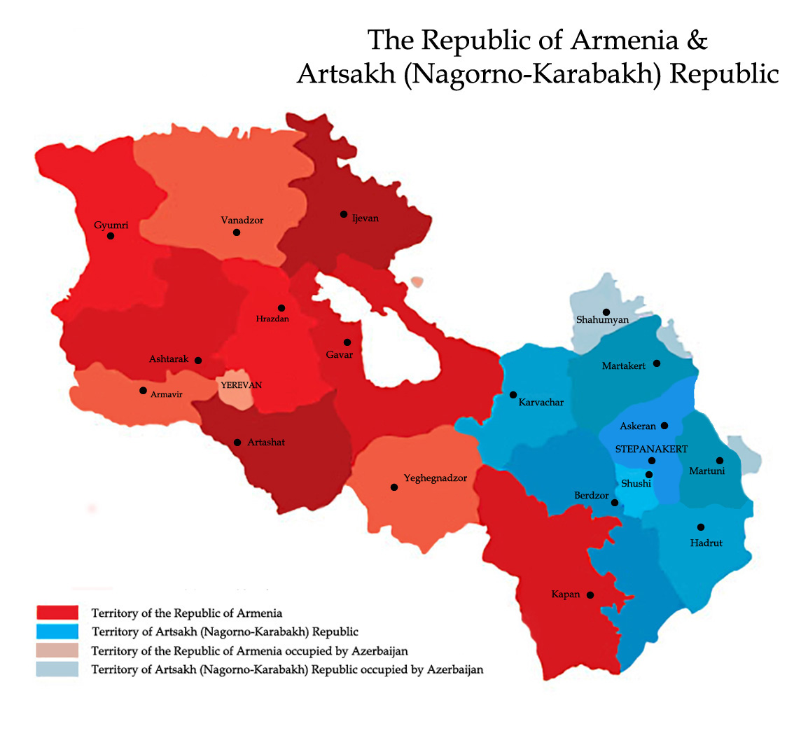
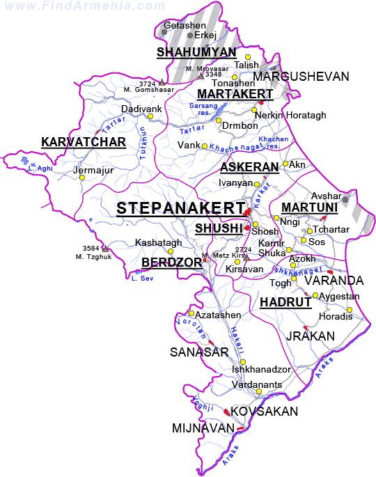
Re: What are the borders of Nagorno-Karabakh?
Post it in blogs, forums, Facebook, YouTube videos or just simply share it with other people. Once it is on the Internet, it should spread like wildfire if enough people share the picture around.
Originally posted by Armanen
View Post


Comment